
TL;DR: Gozo hiking is serious walking, not a gentle stroll. The Victoria Lines ridge, clifftop coastal routes, and village-connecting trails take three to four hours and need decent shoes and an early start.
Gozo hiking is, genuinely, some of the best walking available anywhere in the Mediterranean. The island is small enough to cross in a day yet varied enough to keep you occupied for a week, with limestone cliffs, salt pans, ruined citadels and coastline that changes character every few kilometres.
I should say upfront that I went to Gozo expecting a gentle, unchallenging stroll. What I found was a route along the Victoria Lines ridge that had me genuinely short of breath, questioning my footwear choices, and stopping every ten minutes not out of fatigue but because the views demanded it. Gozo has a habit of wrong-footing you like that.
Why Gozo Hiking Is Worth Planning Properly
Most walkers who visit Malta give Gozo a single day trip. That is enough to see the Azure Window’s former site and pick up a lace doily in Victoria, but it is nowhere near enough to walk the island seriously. The walking trails in Gozo reward longer stays. Some of the best routes connect villages, cliff edges and historic sites in sequences that take three to four hours and are genuinely difficult to replicate on Malta proper.
The terrain is predominantly limestone, which means good grip underfoot but also uneven surfaces that turn unpredictably. Decent shoes matter. The island sits in the central Mediterranean, which means heat from late May through to early October is a real factor. Early morning starts are not a lifestyle preference here; they are a practical necessity on longer routes.
Water sources on the trails are sparse. Carry more than you think you need, particularly on coastal routes where there is little shade and no reliable infrastructure once you leave the village edges.
The Best Gozo Coastal Walks
The coastline is the defining feature of any serious walking itinerary on the island. Gozo coastal walks range from easy cliff-top strolls above Ramla Bay to more demanding traverses along the western cliffs near Dwejra. Each section of coastline has its own character, and they do not blend into each other the way coastal paths sometimes do in the UK.
Dwejra to San Lawrenz
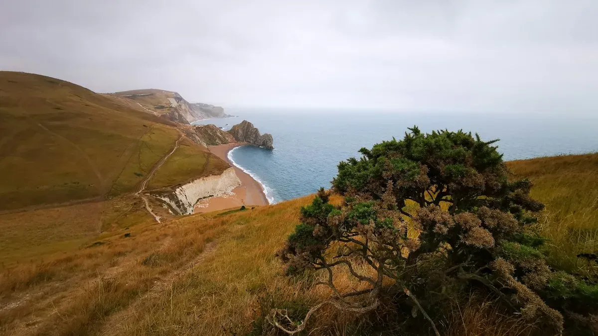
Start at Dwejra Bay, where the Azure Window once stood. The area is still geologically striking: the Inland Sea, the Fungus Rock, and the open sea converging in a small geographic pocket that concentrates Gozo’s drama into one spot. Walking south and inland from here towards San Lawrenz takes you through agricultural terraces and gives a clear sense of how the island’s interior sits in relation to its cliffs.
The route is not technically difficult but the exposed clifftop sections require attention, particularly if there is wind. The path is informal in places, meaning the line you follow is partly your own judgement. That suits confident walkers and frustrates those expecting waymarked paths throughout.
Ramla Bay to Marsalforn
This is probably the most accessible coastal route on the island. Ramla Bay is Gozo’s largest sandy beach, and walking northeast from there towards Marsalforn takes you along headlands with views across to Comino. The distance is manageable in under two hours at a comfortable pace, and Marsalforn itself has enough cafes and restaurants to make it a reasonable end point.
The path rises and falls rather than running flat, so the elevation gain is modest but cumulative. The section above Xwejni Bay, where the salt pans cut geometric shapes into the pale rock, is one of the more photographed stretches of coast in Gozo. It is better experienced slowly than rushed through.
Xlendi to Wied il-Mielah
Xlendi is a small resort village on the southwest coast with a sheltered bay. The walk from Xlendi towards Wied il-Mielah follows cliff edges with steep drops into the sea. This is the kind of route where you feel the exposure more keenly than the distance. The arch at Wied il-Mielah is a natural rock formation that is less visited than Dwejra was in its Azure Window years, which makes it a quieter, more considered destination.
Allow around three hours for this section, and consider the return route carefully before you set out. There is no loop that works neatly here, so most walkers either retrace the cliff path or arrange transport back from the western coast.
Walking Trails Gozo: The Inland Routes
The walking trails in Gozo are not limited to the coast. The interior of the island is a different kind of rewarding: quieter, more agricultural, and shaped by a way of life that has not changed dramatically in several generations. Village to village routes are underused by most visitors, which is their advantage.
The Victoria Ridge Walk
Victoria, known locally as Rabat, sits at the centre of Gozo and is elevated enough to offer views in most directions on a clear day. Walking the ridge that runs near the Citadel gives you a geographic orientation of the island that no map quite replicates. You can see where the coastal valleys cut down to the sea and understand how the villages cluster around water sources.
The Citadel itself is worth a few hours separately, but incorporating it into a longer ridge walk makes the geography read as a coherent whole rather than a set of disconnected sights.
Ta’ Pinu to Gharb
The path from Ta’ Pinu basilica towards Gharb is short, roughly forty minutes, but it passes through countryside that feels genuinely removed from tourism. The basilica is a late nineteenth-century structure built on the site of a reported apparition, and whether or not you engage with that context, the surrounding landscape is peaceful in a way that rewards walking slowly rather than efficiently.
Gharb’s village square is a good spot to stop. The church façade is considered one of the finest baroque examples in the Maltese islands, which in a country that takes baroque architecture seriously means something specific rather than merely decorative.
Practical Considerations Before You Set Out
The Gozo Tourism Authority has produced a set of official walking maps that are available at the ferry terminal and from some accommodation providers. They are useful as a baseline but should not be treated as fully accurate on every waymark or distance. Ground conditions change, paths are rerouted, and some sections described on paper require a degree of improvisation in practice.
Spring, specifically March through to early May, is the best season for serious walking. The vegetation is green, temperatures are manageable, and the coastal light in the mornings is clear enough to see across to Sicily on a good day. Autumn works almost as well. Summer is possible but should be approached with caution and confined to very early morning starts.
A few route-specific notes worth keeping in mind:
- The cliff paths near Dwejra and Xlendi have no barriers. Stay well back from exposed edges, particularly if there has been recent rain.
- Gozo has a bus network, but services are infrequent on some rural routes. Check timetables before planning a one-way walk that depends on public transport for the return.
- Mobile signal is reasonable across most of the island but drops in some of the deeper valleys. Download offline maps before you go rather than assuming connectivity.
- Most trails are not shaded. A hat is practical, not optional.
Frequently Asked Questions
How difficult are the walking trails in Gozo?
They vary considerably. Routes like the Ramla to Marsalforn coastal path are accessible to most walkers with reasonable fitness. The cliff routes near Dwejra and Xlendi are more demanding, not primarily because of distance but because of exposure and uneven terrain. None of the main routes require technical equipment, but good footwear is non-negotiable.
Are there guided walking tours available in Gozo?
Yes. Several local operators offer guided walking days, particularly in spring when visitor numbers support the activity. Guided tours are worth considering for the Dwejra coastal section if you are unfamiliar with the area, as the informal nature of some paths makes it easy to drift onto private land or lose the coastal edge.
Can you walk between villages in Gozo without a car?
Yes, and this is one of the more underappreciated aspects of Gozo hiking. The island is small enough that most village-to-village distances are between forty minutes and two hours on foot. The road network is straightforward, and many informal paths cut across agricultural land where public access has historically been tolerated, though it is worth being respectful of working farmland.
What is the best time of year for gozo coastal walks?
March to May gives you the best combination of comfortable temperatures, green countryside and long daylight hours. October and November work well for coastal routes specifically, as the sea is calm and still warm from the summer. July and August are genuinely difficult for sustained walking; the heat is not just uncomfortable but a safety consideration on exposed cliff paths.
The Bottom Line
- Gozo hiking is more varied and more demanding than most visitors expect. Plan accordingly.
- The coastal paths near Dwejra, Xlendi and along the Ramla to Marsalforn route are the standout options for walkers prioritising scenery.
- Inland routes between villages offer a quieter alternative that most day-trippers miss entirely.
- Spring is the optimal season. Summer requires early starts and careful planning.
- Carry sufficient water, download offline maps, and check bus timetables before committing to a one-way route.
The question worth sitting with, if you are planning a trip, is whether a single day is actually enough. Most people who spend a week in Gozo and walk seriously come back wondering why they ever thought it was only a half-day destination.